Die Luftfotografie: zwischen Erbe und zeitgenössischem Gebrauch
Das Museum für Luft- und Raumfahrt organisiert ein dreitägiges Kolloquium zum Austausch und zur Entdeckung mit dem Titel "Die Luft- und Weltraumfotografie: zwischen Erbe und zeitgenössischen Nutzungen
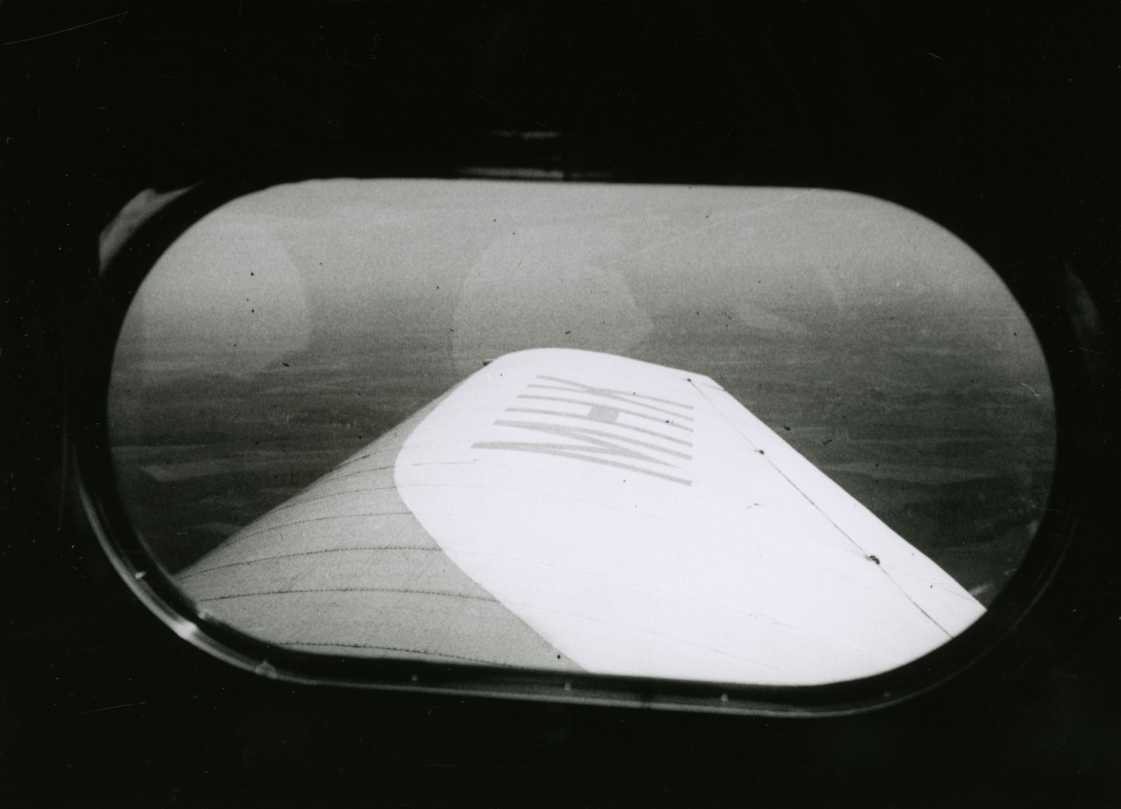
©Henry Beaubois / Coll. musée de l’Air et de l’Espace - Le Bourget
Das Museum für Luft- und Raumfahrt organisiert ein dreitägiges Kolloquium zum Austausch und zur Entdeckung mit dem Titel "Die Luft- und Weltraumfotografie: zwischen Erbe und zeitgenössischen Nutzungen". Dieses Kolloquium zielt darauf ab, die zentrale Frage der Luft- und Raumfotografie als wissenschaftliches, künstlerisches und patrimoniales Werkzeug anzugehen, um eine Darstellung des Luftverkehrs zu erzeugen und zu strukturieren und gleichzeitig unseren Blick auf die Gebiete und deren Nutzung zu erneuern. Diese Veranstaltung wird von einzigartigen Führungen und einer außergewöhnlichen Ausstellung der reichen Fotosammlungen des Museums begleitet.
Seit dem 19. Jahrhundert hat die Luftbildfotografie die Art und Weise der Beobachtung, Darstellung und Analyse von Regionen grundlegend verändert. Durch die Einführung eines Blickwinkels auf städtische und natürliche Landschaften hat sie wissenschaftliche Praktiken, kartografische Geräte und Darstellungsformen des Raumes erneuert. Zunächst im Zusammenhang mit den ersten fotografischen Experimenten und den Anfängen der Luftfahrt, hat sie sich nach und nach als ein wesentliches Werkzeug in Bereichen wie Geographie, Archäologie, Städtebau oder Umweltwissenschaften etabliert.
Im Laufe der Zeit haben die in wissenschaftlichen, administrativen oder militärischen Kontexten produzierten Bilder bedeutende Bestände gebildet, die heute in Archiven, Bibliotheken und denkmalgeschützten Institutionen aufbewahrt werden. Diese Bestände stellen wertvolle Quellen für die Erforschung von Landschaften und ihrer Veränderungen dar, während sie gleichzeitig Fragen der Erhaltung, Digitalisierung und Aufwertung aufwerfen.
Die jüngsten technologischen Entwicklungen - Satellitenbilder, Drohnen, Fotogrammetrie oder digitale Diffusion - haben die Nutzung der Luft- und Weltraumfotografie grundlegend erneuert und die Formen der Produktion und Verbreitung von Bildern, die von oben betrachtet werden, vervielfacht. In diesem Zusammenhang wird dieses Kolloquium die Luft- und Raumfotografie aus einer interdisziplinären Perspektive hinterfragen, indem es sich mit ihrer Geschichte, ihren Erkenntnisprozessen, ihren zeitgenössischen Verwendungen sowie den wissenschaftlichen Herausforderungen befasst. künstlerisch und rechtlich mit der Verbreitung dieser Bilder verbunden.
Aerial photography: between heritage and contemporary uses
The Air and Space Museum is organizing a three-day symposium of exchange and discovery entitled "Aerial and spatial photography: between heritage and contemporary uses". This conference...
©Henry Beaubois / Coll. musée de l’Air et de l’Espace - Le Bourget
The Air and Space Museum is organizing a three-day symposium of exchange and discovery entitled "Aerial and spatial photography: between heritage and contemporary uses". This symposium aims to address the central question of aerial and space photography as a scientific, artistic, and heritage tool, in order to produce and structure a representation of aerial phenomena while renewing our perspective on territories and their uses. This event is accompanied by unique guided tours and an exceptional exhibition of the museum’s rich photographic collections.
Since the 19th century, aerial photography has profoundly transformed the ways of observing, representing and analyzing territories. By introducing an overhanging point of view on urban and natural landscapes, it has renewed scientific practices, cartographic devices and forms of representation of space. Initially linked to the first photographic experiments and the beginnings of aviation, it gradually established itself as an essential tool in fields such as geography, archaeology, urban planning or environmental sciences.
Over time, images produced in scientific, administrative or military contexts have constituted important corpora today preserved in archives, libraries and heritage institutions. These funds represent valuable sources for the study of landscapes and their transformations, while raising issues of conservation, digitization and enhancement.
Recent technological developments—satellite imagery, drones, photogrammetry, or digital broadcasting—have profoundly renewed the uses of aerial and space photography and multiplied the forms of production and circulation of images seen from above. In this context, this conference will examine aerial and spatial photography from an interdisciplinary perspective, focusing on its history, heritage processes, contemporary uses, and scientific issues, artistic and legal related to the circulation of these images.
La fotografia aerea: tra eredità e usi contemporanei
Il museo dell'aria e dello spazio organizza un simposio di tre giorni di scambio e di scoperta intitolato "La fotografia aerea e spaziale: tra eredità e usi contemporanei". Questo simposio...
©Henry Beaubois / Coll. musée de l’Air et de l’Espace - Le Bourget
Il museo dell'aria e dello spazio organizza un simposio di tre giorni di scambio e di scoperta intitolato "La fotografia aerea e spaziale: tra eredità e usi contemporanei". Questo simposio si propone di affrontare la questione centrale della fotografia aerea e spaziale come strumento scientifico, artistico e patrimoniale, per produrre e strutturare una rappresentazione del fatto aereo, rinnovando il nostro sguardo sui territori e sui loro usi. Questa manifestazione è accompagnata da visite guidate inedite e da un'esposizione eccezionale delle ricche collezioni fotografiche del museo.
Dal XIX secolo, la fotografia aerea ha profondamente trasformato i modi di osservare, rappresentare e analizzare i territori. Introducendo un punto di vista che si affaccia sui paesaggi urbani e naturali, ha rinnovato le pratiche scientifiche, i dispositivi cartografici e le forme di rappresentazione dello spazio. Inizialmente legata alle prime sperimentazioni fotografiche e agli inizi dell'aviazione, si è progressivamente imposta come uno strumento essenziale in settori quali la geografia, l'archeologia, l'urbanistica o le scienze ambientali.
Nel corso del tempo, le immagini prodotte in contesti scientifici, amministrativi o militari hanno costituito importanti corpus oggi conservati in archivi, biblioteche e istituzioni patrimoniali. Questi fondi rappresentano fonti preziose per lo studio dei paesaggi e delle loro trasformazioni, sollevando al contempo questioni di conservazione, digitalizzazione e valorizzazione.
Le recenti evoluzioni tecnologiche - immagini satellitari, droni, fotogrammetria o diffusione digitale - hanno profondamente rinnovato gli usi della fotografia aerea e spaziale e moltiplicato le forme di produzione e circolazione delle immagini viste dall'alto. In questo contesto, il simposio interrogherà la fotografia aerea e spaziale da una prospettiva interdisciplinare, interessandosi alla sua storia, ai suoi processi di patrimonializzazione, ai suoi usi contemporanei e alle questioni scientifiche, artistici e giuridici legati alla circolazione di queste immagini.
La photographie aérienne : entre héritage et usages contemporains
Le musée de l’Air et de l’Espace organise un colloque de trois jours d’échange et de découverte intitulé « La photographie aérienne et spatiale : entre héritage et usages contemporains ». Ce colloque…
©Henry Beaubois / Coll. musée de l’Air et de l’Espace - Le Bourget
Le musée de l’Air et de l’Espace organise un colloque de trois jours d’échange et de découverte intitulé « La photographie aérienne et spatiale : entre héritage et usages contemporains ». Ce colloque vise à aborder la question centrale de la photographie aérienne et spatiale comme outil scientifique, artistique et patrimonial, pour produire et structurer une représentation du fait aérien, tout en renouvelant notre regard sur les territoires et leurs usages. Cette manifestation s'accompagne de visites guidées inédites et d'une expositions exceptionnelles des riches collections photographiques du musée.
Depuis le XIXe siècle, la photographie aérienne a profondément transformé les manières d’observer, de représenter et d’analyser les territoires. En introduisant un point de vue surplombant sur les paysages urbains et naturels, elle a renouvelé les pratiques scientifiques, les dispositifs cartographiques et les formes de représentation de l’espace. D’abord liée aux premières expérimentations photographiques et aux débuts de l’aviation, elle s’est progressivement imposée comme un outil essentiel dans des domaines tels que la géographie, l’archéologie, l’urbanisme ou encore les sciences de l’environnement.
Au fil du temps, les images produites dans des contextes scientifiques, administratifs ou militaires ont constitué d’importants corpus aujourd’hui conservés dans des archives, bibliothèques et institutions patrimoniales. Ces fonds représentent des sources précieuses pour l’étude des paysages et de leurs transformations, tout en soulevant des enjeux de conservation, de numérisation et de valorisation.
Les évolutions technologiques récentes — imagerie satellitaire, drones, photogrammétrie ou diffusion numérique — ont profondément renouvelé les usages de la photographie aérienne et spatiale et multiplié les formes de production et de circulation des images vues d’en haut. Dans ce contexte, ce colloque interrogera la photographie aérienne et spatiale dans une perspective interdisciplinaire, en s’intéressant à son histoire, à ses processus de patrimonialisation, à ses usages contemporains ainsi qu’aux enjeux scientifiques, artistiques et juridiques liés à la circulation de ces images.
La fotografía aérea: entre herencia y usos contemporáneos
El museo del aire y del espacio organiza un coloquio de tres días de intercambio y descubrimiento titulado "La fotografía aérea y espacial: entre herencia y usos contemporáneos". Este simposio...
©Henry Beaubois / Coll. musée de l’Air et de l’Espace - Le Bourget
El museo del aire y del espacio organiza un coloquio de tres días de intercambio y descubrimiento titulado "La fotografía aérea y espacial: entre herencia y usos contemporáneos". Este coloquio tiene como objetivo abordar la cuestión central de la fotografía aérea y espacial como herramienta científica, artística y patrimonial, para producir y estructurar una representación del hecho aéreo, renovando nuestra mirada sobre los territorios y sus usos. Esta manifestación se acompaña de visitas guiadas inéditas y de una exposición excepcional de las ricas colecciones fotográficas del museo.
Desde el siglo XIX, la fotografía aérea ha transformado profundamente las formas de observar, representar y analizar los territorios. Al introducir un punto de vista que domina los paisajes urbanos y naturales, renovó las prácticas científicas, los dispositivos cartográficos y las formas de representación del espacio. Vinculada en primer lugar a los primeros experimentos fotográficos y al inicio de la aviación, se ha ido imponiendo progresivamente como una herramienta esencial en campos como la geografía, la arqueología, el urbanismo o las ciencias del medio ambiente.
Con el tiempo, las imágenes producidas en contextos científicos, administrativos o militares han constituido importantes corpus que hoy se conservan en archivos, bibliotecas e instituciones patrimoniales. Estos fondos representan fuentes valiosas para el estudio de los paisajes y sus transformaciones, al tiempo que plantean cuestiones de conservación, digitalización y valorización.
Las evoluciones tecnológicas recientes -imágenes satelitales, drones, fotogrametría o difusión digital- han renovado profundamente los usos de la fotografía aérea y espacial y multiplicado las formas de producción y circulación de las imágenes vistas desde arriba. En este contexto, el simposio examinará la fotografía aérea y espacial desde una perspectiva interdisciplinaria, con un interés por su historia, sus procesos de patrimonialización, sus usos contemporáneos así como los desafíos científicos, artísticos y jurídicos relacionados con la circulación de estas imágenes.


